I wrote about my trip to Oman a while back but only covered the day trip I took to the town of Salalah in the southern part of the country. I actually spent the bulk of my time in and around Oman’s capital, the Gulf city of Muscat. Oman is really a hidden gem as far as I’m concerned. It’s a relatively sleepy place (Muscat is its largest city and clocks in at somewhere between 600,000 and 750,000 people) but boasts some spectacular scenery, plenty of opportunities to relax and soak up the sun if that’s your game, and a fair amount of interesting historical sites if that’s more your speed. The tourist scene is significant (and maybe much increased since I was there a decade ago) but you shouldn’t encounter crowds anywhere near what you’d find in other places in the region (Dubai, Egypt, Lebanon, etc.). Muscat either takes its name from the Arabic word masqat, which can mean “the place where something falls” or “birthplace,” or from an Old Persian root meaning “strong smelling”–presumably the same Indo-European root from which we get “musk” today. Given the importance of both seafaring (making it a place where anchors fall, get it?) and the incense trade to Muscat’s history, these are both reasonable theories in my humble opinion.
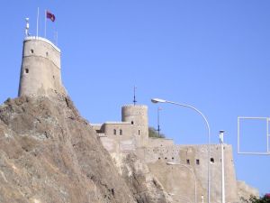
Muscat itself is right on the Gulf of Oman, which is itself an inlet off of the Arabian Sea, and is right outside the Strait of Hormuz that marks the entrance into the Persian/Arabian (don’t want to offend anybody!) Gulf and its harbor offers some spectacular views. The city was controlled by the Portuguese from the early 16th century through the middle of the 17th century, and in order to defend the harbor from Ottoman incursions they built a number of fortifications on high points all throughout the city, so you can be walking along, look up, and there’s a centuries-old fort overhead, just sitting there. Very view of these places are open to tourists but they’re a very cool addition to the scenery.


Fort al-Jalali, one of the Portuguese fortifications that actually is open to the public
Another major Portuguese fort
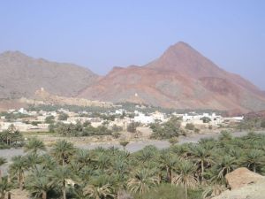
Scenery just outside of Muscat
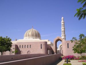
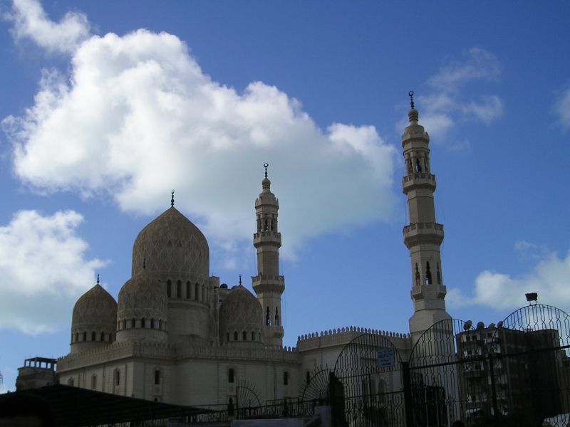
The Sultan Qaboos Grand Mosque, built in 2001, is massive and quite impressive, probably the nicest looking mosque I saw in the Gulf:
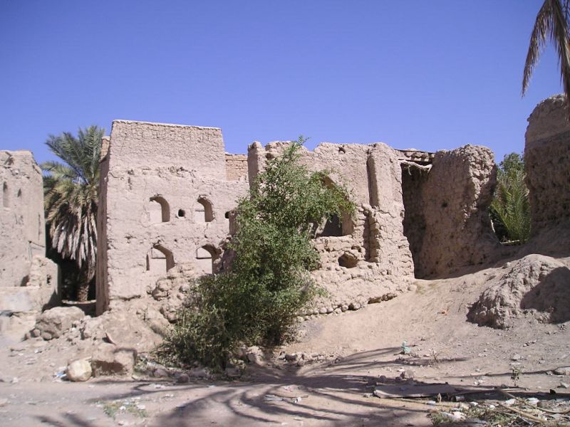
There are several interesting sites in the area around Muscat as well. Maybe the most important of these is the Bahla Fort, an extremely well-preserved 13th-14th century fortress built by the tribe that controlled the region at the time and was openly resistant to caliphal, then Mongolian, rule. Bahla was a center of resistance to the caliphate going back centuries before this fort was built, and the fort preserves both a pre-gunpowder style of fortification as well as traditional Arabian water infrastructure. Unfortunately I didn’t get to see any of that infrastructure because, after falling into complete disrepair, Bahla became a UNESCO Heritage Site in the late 1980s and was closed to the public until just last year while undergoing extensive renovation. I did see the outside, complete with scaffolding, though:

Bahla Fort, from a distance

Bahla, up close
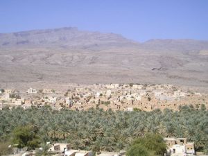
There was more great scenery around Bahla to take in:

The Nakhal Fort, about 75 miles east of Muscat, is another centuries-old fortification and has been much better maintained than Bahla; today it houses a museum that I think is primarily focused on gunpowder weapons. I mention Nakhal for anybody thinking about visiting Oman, but I didn’t make it there myself. It was either a day trip there or a day trip to Salalah and Salalah won out.
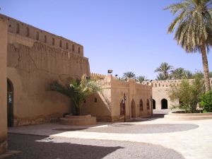
Another historical site near Muscat is Nizwa, which used to be the capital of inland Oman and sits on the caravan route from the interior of Oman to the port at Muscat, so as you might expect it’s known for its historic marketplace and fortress:

Ruins of the Nizwa Suq, or market; the modern Suq is still there and probably the most important market in Oman outside of Muscat

Nizwa fortress, built in 1668
The courtyard of Nizwa Fort

The view from the top of the tower of Nizwa Fort


